Wednesday, October 17, 2012

Turpan

A flight from Kashgar to Urumqi and then a 2.5 hour bus ride east into the Death Valley of China, Turpan.  Expecting a hot desert, we were surprised to see so much green.  Turns out Turpan is known for its grapes!!  We arrived just as the harvest was ending, but grapes were being sold everywhere.

We rented some bikes and toured around Turpan at our leisure. 

A Uyghur Mosque (built in 1777) with the Emin Minaret, the tallest minaret in all of China.


On our bike ride, we saw so many murals.  I love the themes and messages.


A bike ride out to the Jiaohe Ruins.

A combination of the ruins and on this clear day, the Tian Shan's in the background.....fantastic.

What are these mystery buildings?

They are for drying grapes into raisins.  Trust me, these raisins make Sunmaid raisins taste like cardboard.  The intensity of flavor........wow.  I brought home two kilograms!

The afternoon of the second day, Sam and I met an American on the street and the three of us grabbed a cab and took a drive to the Flaming Mountains.  Those were a dud, but we then asked to be driven up to the Bezelik Caves and this was the drive up.


The wall paintings of the caves were taken by German archeologists in the early 1900's and so there wasn't anything to see.  The desert scenery was worth it alone.

Waiting for the bus back to Urumqi.

Tuesday, October 16, 2012

Street Food with Ernie and Sam

In our week traveling, this might be one of the two times Sam and I sat down and ate IN a restaurant.

Most of the time it was street food.  Walk around a market and eat what looks good.


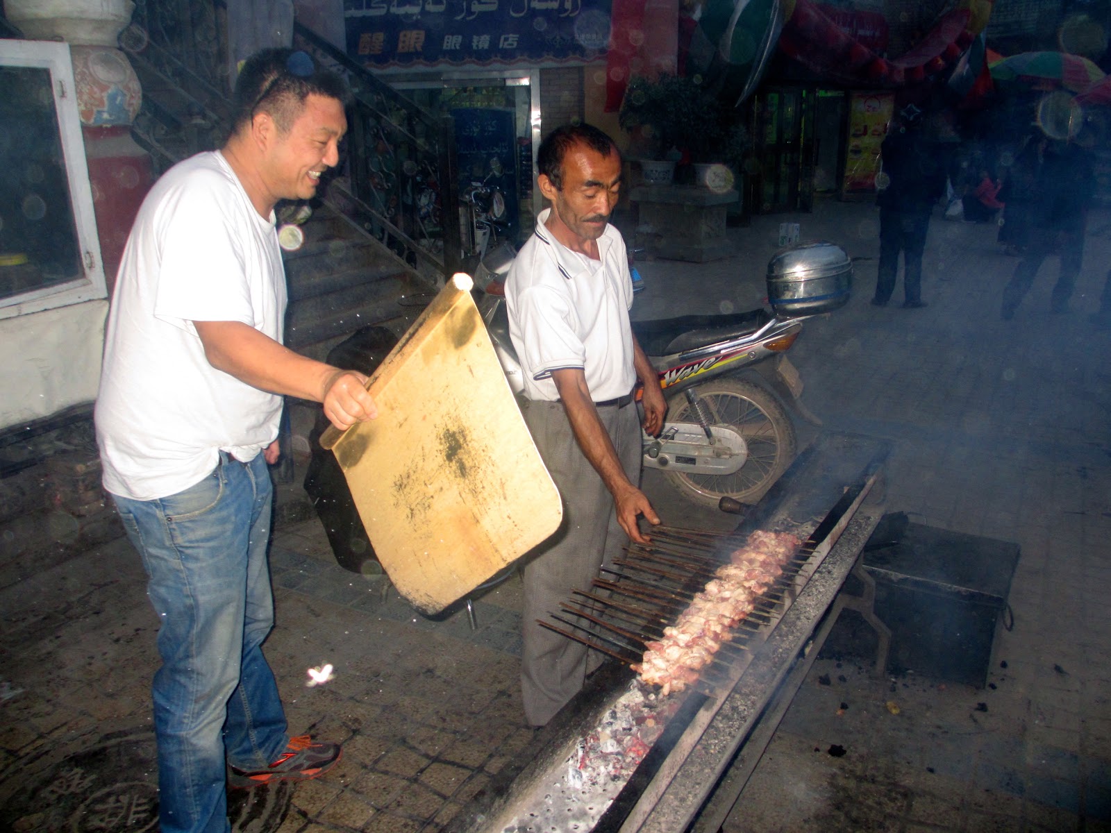
Mutton and lamb kebabs are a staple!

Who knew that some of the best bagels I've ever tasted can be found in Central Asia.  Cost of a bagel?  About 16 cents US.

Slices of fruit anytime, anyplace.  The melons here in Western China were in season and unbelievable.

I was a huge fan of the "lamb hotpocket."  I ate them by the bagful.


Sam and I craved these "crepes", which had breaded chicken, lettuce, onions, a fried egg and some special sauce.

Our traditional dining location.

This is the emotion when one finds out that the street of food you thought was open....is closed.

Monday, October 15, 2012

Karakoram Highway

Heading south from Kashgar is the famed Karakoram Highway (KKH), which takes to the border with Pakistan. Sam, myself and a third found a driver and hit the road for an overnight down on the KKH.

As we drove south out of Kashgar, we saw some beautiful red mountains.

Everything is BIG here.  Here's a HUGE alluvial fan.

But it was these mountains that were our goal.  They kept getting closer and closer.

The KKH winds through some narrow valleys, which are prone to rock slides, which close the road.  We got stuck in an hour long wait as a slide had reduced two lanes to one.

So, you just get out of the car...

....and take a look at the scenery.

Here is Kongur Tagh, the highest mountain wholly within Xinjiang Province.  It stands 7,719 meters tall, or 25,324 feet above sea level.  And yes, the weather was this gorgeous.  Clear, crisp and not freezing cold.


Heading south, we came upon "Sand Lake" (not sure if that's the actual name.  But you'll see it's surrounded by sand dunes.


Sam, myself and our new friend Valentina.  She is Italian and has lived in China for seven years.  She speaks better Chinese than me!

There are many police stops along the KKH.  I gather most are simply to keep track of who's coming in and out of what is a politically sensitive border region.  You'll notice that on the bottom right it points towards the China-Pakistan boundary.  Never thought I would get so close to Pakistan.

Heading south, our southernmost point (and closest to Pakistan) was Tashkurgan.  At this pass, it is the geographic and cultural break with mostly Kyrgyz north of the pass and Tajiks south of the pass.

Here's a map to give you an idea of where we were in the world.  Seriously, this part of China is only China on a technicality.

Taskurgan!!

Looking west from Tashkurgan is the eastern Pamir mountains.  Over those mountains....Tajikistan.

The Tajiks have a myth that they are "descendants of eagles" therefore this statue in the center of the town of Tashkurgan.

Sam on the ruins of the old fort.  Apparently scenes from the movie "The Kite Runner" were filmed here.

The grasslands!! Apparently in the summer, when the grass is high and the wildflowers are in bloom it's spectacular.  Still, I was pretty happy with what we saw.


Heading back towards Kashgar, we stopped and stayed the night along the shore of Karakul Lake (around 3,600 meters or 11,811 feet above sea level).

Karakul Lake with Muztagh Ata (7,546 meters or 24,757 feet above sea level) in the distance.  Muztagh Ata is second in elevation to Kongur Tagh.


Locals set up yurts to house tourists for the night.  We also got dinner.

A wonderful meal cooked here in the yurt.  Proof that good cooking doesn't need fancy machines, just a solid stove and basic utensils.

Our driver in the blue jacket.

Sam and Valentina with our bedding behind.  Sleeping in a yurt means sleeping on pads on the floor with think covers.

Dusk and the last light on Muztagh Ata

FULL MOON!!!!